Sardis
About Sardis
Located in western Anatolia at the edge of the fertile Hermus plain and at the foot of the Tmolus mountains, on a major route connecting the Aegean with inland Turkey, around a naturally defensible citadel by the banks of a river with golden sands, Sardis was blessed with many natural advantages (figs. 1, 2, 3, 4, 5). The city became the capital of the Lydian empire in the seventh and sixth centuries BC, when a dynasty of kings from Gyges to Croesus conquered western Anatolia, invented the world’s first coins, and concluded treaties with the great civilizations of Mesopotamia, Egypt, and Greece. Its kings were legendary among the Greeks for their wealth and beneficence, building temples and dedicating precious objects and many tons of gold at Greek sanctuaries such as Ephesus, Didyma and Delphi (see Kerschner, “Ionians”). The citadel of Sardis was famous throughout history as “the strongest place in the world” (figs. 6, 7), and the lower city was defended by a mighty fortification 20 meters thick (fig. 8). The tumuli at Sardis’ royal necropolis at Bin Tepe are among the largest in the world (fig. 9; see also Baughan, “Burial Customs”).
Under the Achaemenid Persians (547 - 334 BC), Sardis was the capital of a major satrapy (province) of Asia Minor, and the mustering-point for the invasions of Greece under the Great Kings Darius and Xerxes. Many of the known tombs date to this period (figs. 10, 11), and excavations of the cemeteries of Sardis from 1910-1914 produced wonderful examples of jewelry of this period, now in the Istanbul Archaeological Museum (figs. 12, 13, 14, 15).
After Alexander the Great’s conquest, Sardis was incorporated into the Hellenistic kingdoms and formed the western capital of the Seleucid empire. It was probably under their patronage that the great Temple of Artemis (also About the Temple of Artemis) was begun on the site of an earlier sanctuary (figs. 16 - 17). The theater of Sardis, now sadly ruined, was first built in this period as part of the conversion of this Anatolian capital into a Hellenistic polis (figs. 18, 19, 20).
The city flourished under the Roman peace, and boasted a temple of the imperial cult (fig. 21), important baths (figs. 22, 23), a stadium, aqueducts, and other civic buildings. It is famous as one of the Seven Churches of Asia in the Book of Revelation, but no church buildings have been found dating to this era.
In the reorganization of the Roman Empire under Diocletian, Sardis became a provincial capital of Lydia, and it flourished particularly in the fourth and fifth centuries AD. The late Roman synagogue of Sardis is the largest known synagogue of the ancient world (figs. 24, 25, 26). The city’s churches included a fourth-century church outside the city walls (fig. 27, 28), a chapel attached to the temple of Artemis (fig. 29, 30), and a large basilica near the center of the city (fig. 31). Late Roman houses (figs. 32, 33) and the “Byzantine Shops” at the periphery of the city (fig. 34) attest its growing size and population.
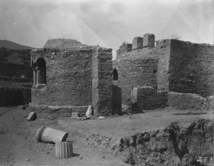
Like many cities of this region, Sardis fell into decline in the sixth and early seventh centuries AD, and the lower city was largely abandoned by the seventh century. The acropolis, however, described by Polybius as “the strongest place in the world,” remained an important citadel and stronghold through the Byzantine period (figs. 35, 36).
The ancient name of the city, Sfar- in Lydian, Sparda in Persian, and Σάρδεις or Σάρδις in Greek, is still reflected in the modern name of the town, Sart.
-

Fig. 1
Map of the Near East showing Lydia and its neighbors (©Archaeological Exploration of Sardis/President and Fellows of Harvard College; Landsat image courtesy NASA.)
-

Fig. 2
Map of Anatolia, showing the approximate boundaries of Lydia, the extent of the Lydian Empire, and important sites (©Archaeological Exploration of Sardis/President and Fellows of Harvard College; Landsat image courtesy NASA.)
-

Fig. 3
View of Sardis (©Archaeological Exploration of Sardis/President and Fellows of Harvard College)
-

Fig. 4
View of Sardis from the Hermus plain. On the left, one of the peaks of the Boz Dağ (Mt. Tmolus). Center: The Acropolis of Sardis; the Lydian terraces of ByzFort and Field 49 are immediately below; on the right, the Roman Bath-Gymnasium complex (©Archaeological Exploration of Sardis/President and Fellows of Harvard College)
-

Fig. 5
View of Sardis from the Tmolus (Boz Dağ) (©Archaeological Exploration of Sardis/President and Fellows of Harvard College)
-

Fig. 6
The Acropolis of Sardis, showing the Byzantine fortifications (“Flying Towers”) (©Archaeological Exploration of Sardis/President and Fellows of Harvard College)
-

Fig. 7
Plan of Sardis (©Archaeological Exploration of Sardis/President and Fellows of Harvard College)
-

Fig. 8
View of the Lydian fortification of Sardis (©Archaeological Exploration of Sardis/President and Fellows of Harvard College)
-

Fig. 9
View of Bin Tepe (©Archaeological Exploration of Sardis/President and Fellows of Harvard College)
-

Fig. 10
View of the Pyramid Tomb (©Archaeological Exploration of Sardis/President and Fellows of Harvard College)
-

Fig. 11
Reconstruction drawing of the Pyramid Tomb (©Archaeological Exploration of Sardis/President and Fellows of Harvard College)
-

Fig. 12
Gold appliques from a Persian-period tomb at Sardis (IAM 4652, 4653) (Photograph by Crawford H. Greenewalt, jr.)
-

Fig. 13
Persian-period pyramidal stamp seal with gold mounting from Sardis, Cat. No. 129 [IAM 4641] (Courtesy of the Vedat Nedim Tör Museum, Istanbul)
-

Fig. 14
Gold rattle, of unknown purpose, from tomb 213 at Sardis, Cat. No. 135 [IAM 4562] (Courtesy of the Vedat Nedim Tör Museum, Istanbul)
-

Fig. 15
Gold earrings from Sardis, Cat. No. 117 (Courtesy of the Vedat Nedim Tör Museum, Istanbul)
-

Fig. 16
View of the Temple of Artemis and Acropolis (©Archaeological Exploration of Sardis/President and Fellows of Harvard College)
-

Fig. 17
Temple of Artemis columns and Acropolis (©Archaeological Exploration of Sardis/President and Fellows of Harvard College)
-

Fig. 18
View of the theater and stadium at Sardis (©Archaeological Exploration of Sardis/President and Fellows of Harvard College)
-

Fig. 19
Theater before excavation (©Archaeological Exploration of Sardis/President and Fellows of Harvard College)
-

Fig. 20
Theater during excavation (©Archaeological Exploration of Sardis/President and Fellows of Harvard College)
-

Fig. 21
Temple of the Roman Imperial Cult (“Wadi B temple”) (©Archaeological Exploration of Sardis/President and Fellows of Harvard College)
-

Fig. 22
View of the Bath-Gymnasium Complex (©Archaeological Exploration of Sardis/President and Fellows of Harvard College)
-

Fig. 23
View of the Marble Court of the Bath-Gymnasium Complex (©Archaeological Exploration of Sardis/President and Fellows of Harvard College)
-

Fig. 24
View of the Synagogue (©Archaeological Exploration of Sardis/President and Fellows of Harvard College)
-

Fig. 25
View of the Synagogue (©Archaeological Exploration of Sardis/President and Fellows of Harvard College)
-

Fig. 26
Marble menorah from the Synagogue (©Archaeological Exploration of Sardis/President and Fellows of Harvard College)
-

Fig. 27
View of Church E (©Archaeological Exploration of Sardis/President and Fellows of Harvard College)
-

Fig. 28
Reconstruction drawing of Church E (©Archaeological Exploration of Sardis/President and Fellows of Harvard College)
-

Fig. 29
View of Church M in 1912 (Howard Crosby Butler Archive, Department of Art and Archaeology, Princeton University)
-

Fig. 30
View of Church M, 2014 (©Archaeological Exploration of Sardis/President and Fellows of Harvard College)
-

Fig. 31
View of Building D (©Archaeological Exploration of Sardis/President and Fellows of Harvard College)
-

Fig. 32
Apsidal room with painted walls, of a late Roman house in sector MMS (©Archaeological Exploration of Sardis/President and Fellows of Harvard College)
-

Fig. 33
Reconstruction of a painted apsidal room of a late Roman house in sector MMS (©Archaeological Exploration of Sardis/President and Fellows of Harvard College)
-

Fig. 34
View of the Byzantine Shops (©Archaeological Exploration of Sardis/President and Fellows of Harvard College)
-
Fig. 35
View of the Acropolis (©Archaeological Exploration of Sardis/President and Fellows of Harvard College)
-

Fig. 36
View of the Acropolis (©Archaeological Exploration of Sardis/President and Fellows of Harvard College)


Further Reading
Hanfmann, Sardis from Prehistoric to Roman Times; The Lydians and Their World (e.g. Introduction and The City of Sardis); Dusinberre, Aspects of Empire in Achaemenid Sardis; Ratté, “Hellenistic Sardis”; Rautman, “Sardis in Late Antiquity”; Hanfmann and Waldbaum, A Survey of Sardis and the Major Monuments Outside the City Walls.